photo:Kazumasa Matusi
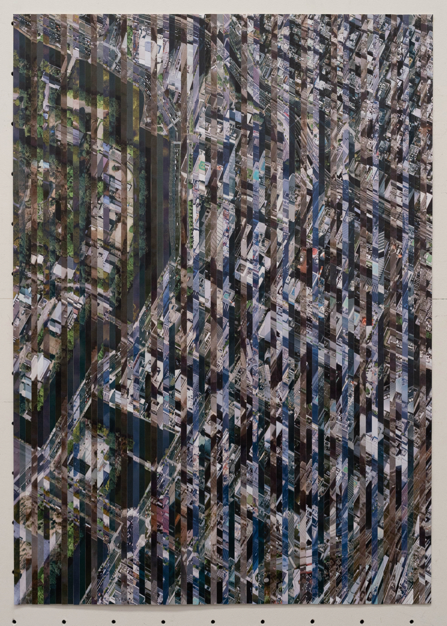
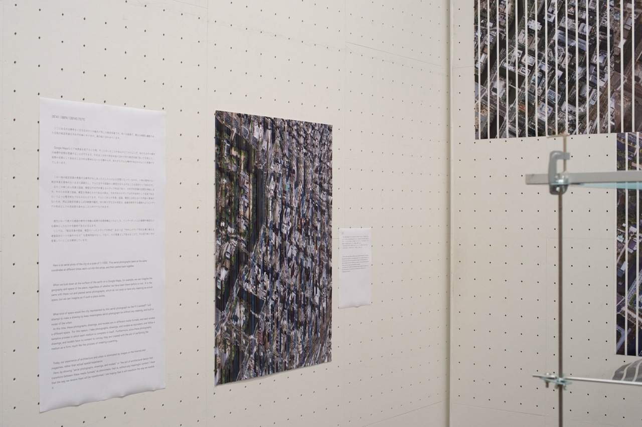
ここにあるのは都市を1000分の1の縮尺で写した航空写真です。同一の座標で、異なる時間に撮影された5枚の航空写真をそれぞれ細く切り分け、再び貼り合わせています。
Google Mapsなどで地表面を見下ろした時、そこに行ったことがあるかどうかによらず、私たちはその場所の地理や空間を想像することができます。それはこの切り刻まれ貼り合わされた航空写真であっても同じで、実際の空間として存在もしなければ意味もないにも関わらず、あたかもそんな場所があるかのように想像できてしまいます。
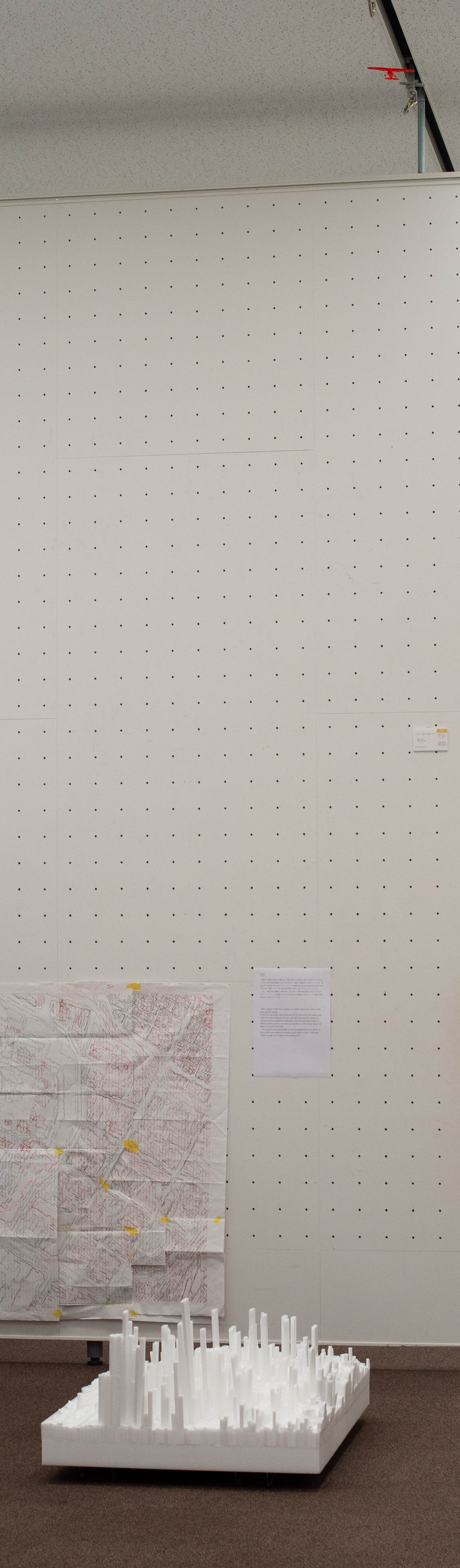
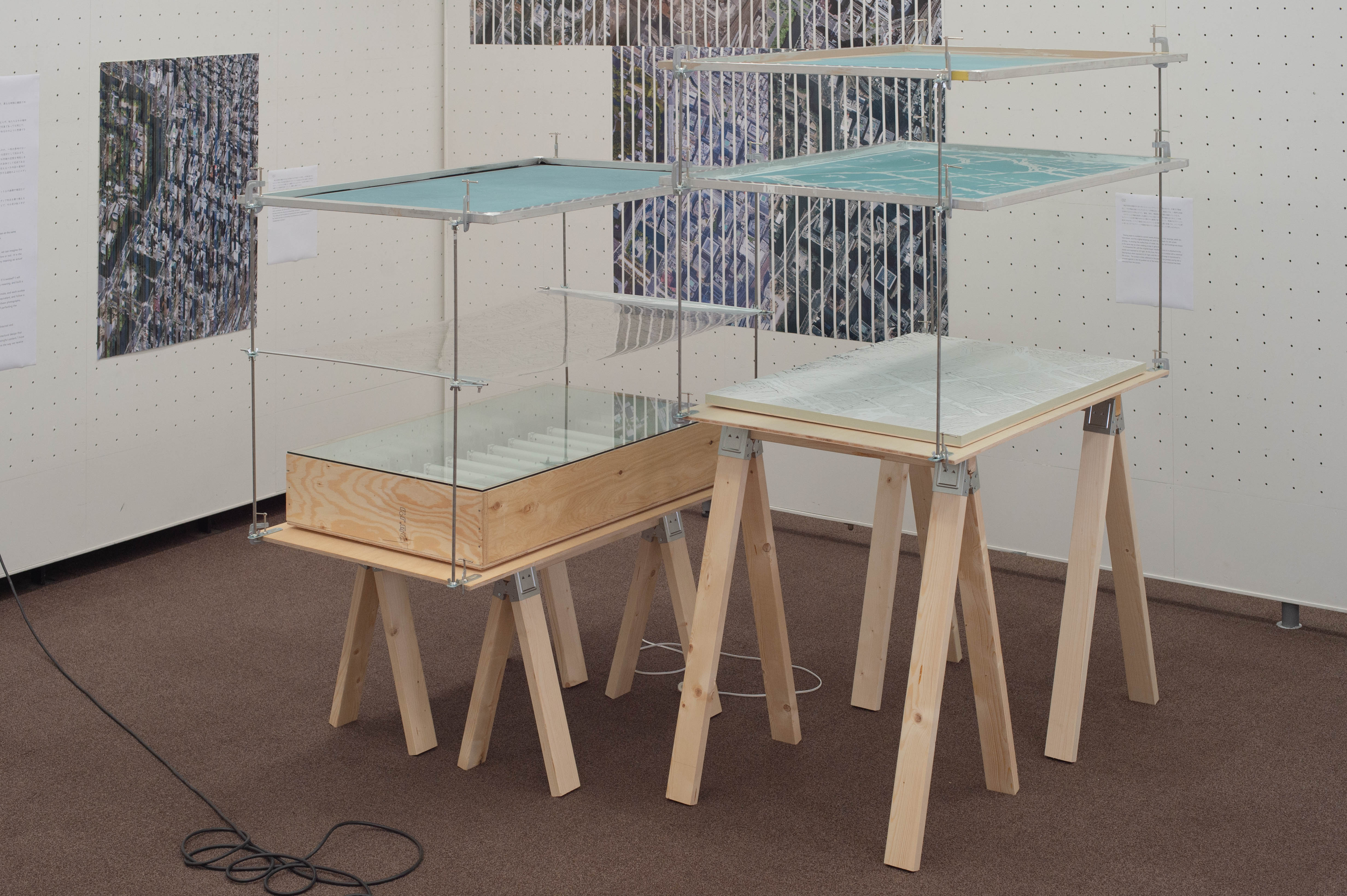
この一枚の航空写真が表象する都市がもしあったとしたらどんな空間になっているのか、一枚の意味のない航空写真を意味のないままに図面化し、さらにはその図面から模型を立ち上げることを設計として試みます。
またこの時これら写真と図面、模型はそれぞれ異なるメディア形式であり、それぞれ別個の空間を喚起します。そのため写真と図面、模型を等価なものであると捉え、それぞれのメディアはそれ自体として完成であるというような暫定的なプロセスをたどります。さらにこれらの写真、図面、模型には伝えるべき内容=意味がないため、例えば航空写真ならば分割数や縮尺、切り取り方などの決定は、絵画を制作する過程のようにメディアの形式としての完成度を高めることに向けてなされます。
現代において我々の建築や都市の体験は実際の空間体験よりもむしろ、Google Mapsを含めたインターネット上の画像や雑誌などを媒体としたものが支配的であると言えます。
ここでは、 ”航空写真や図面、模型といったメディアの形式” あるいは ”それらメディア形式を乗り換える建築設計という行為そのもの” を意味内容のないままに、つまり、ただ現象として見せることで、その受け取り方が変質していくことを期待しています。
Here is an aerial photo of the city at a scale of 1/1000. Five aerial photographs taken at the same coordinates at different times, each cut into thin strips, and then pasted back together.
When we look down at the surface of the earth on a Google Maps, for example, we can imagine the geography and space of the place, regardless of whether we have been there before or not. It is the same with these cut and pasted aerial photographs, which do not exist or have any meaning as actual space, but we can imagine as if such a place exists.
What kind of space would the city represented by this aerial photograph be like if it existed? I will attempt to make a drawing by keep meaningless aerial photograph be without any meaning, and built a model of the urban.
At this time, these photographs, drawings, and models are in different media formats, and each evokes a different space. For this reason, I take photographs, drawings, and models as equivalent, and follow a tentative process in which each medium is complete in itself. Furthermore, since these photographs, drawings, and models have no content to convey, they are created with the aim of perfecting the medium as a form, much like the process of creating a painting.
Today, our experience of architecture and urban is dominated by images on the Internet and magazines, rather than actual spatial experience.
Here, by showing "aerial photographs, drawings, and models" or "the act of architectural design that transitions between these media formats" as phenomena, that is, without any meaningful content, I hope that the way we receive them will be transformed. I am hoping that it will transform the way we receive it.
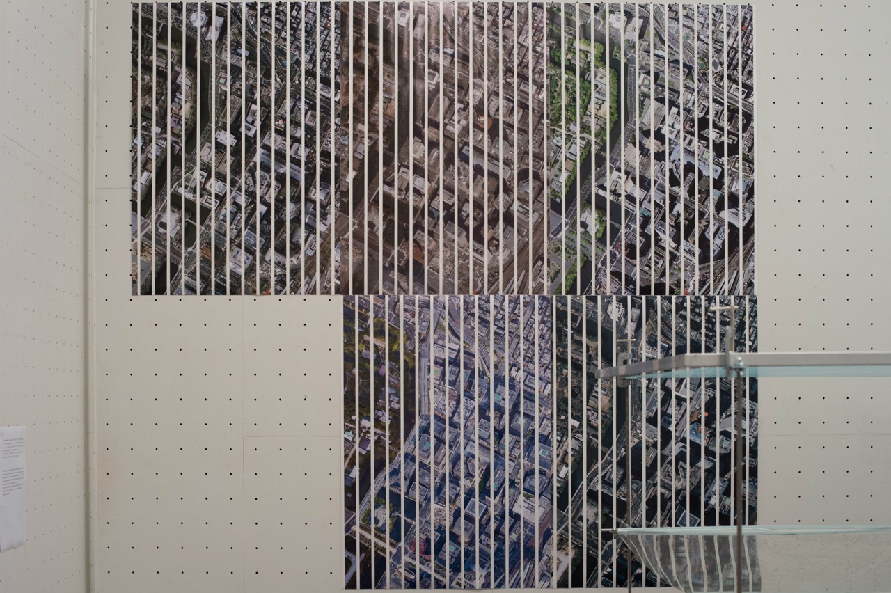
異なる時間に撮影された5つの写真をそれぞれ縦に70分割し、年代順に貼り合わせることで再び一枚の航空写真を作ります。5つの写真は全て同じ座標の上空約4000メートルからセスナ機によって撮影されたもの(一般的に地球全体を見るような写真は衛星によって撮影されるが、高解像度のものはセスナ機で部分的撮影されたものが繋ぎ合わされる)ですが、その時の天候やレンズの位置のなどの諸条件の違いによって、綺麗には繋がりません。
5枚の写真を切り刻み、再び貼り合わせることで、セスナ機やその周りを満たしている空気の存在が 、”写真のずれ” という現象として表出します。
The five photos were taken at different times, divided vertically into 70 sections, and pasted back together in chronological order to form a single aerial photo. All five photos were taken by a Cessna plane from about 4,000 meters above the same coordinates, but due to differences in weather conditions and the position of the lens at the time, they are not beautifully connected.
By cutting up the five photos and pasting them back together, the existences of the Cessna and the air surrounding it are showed up as a phenomenon of "misalignment of photos".
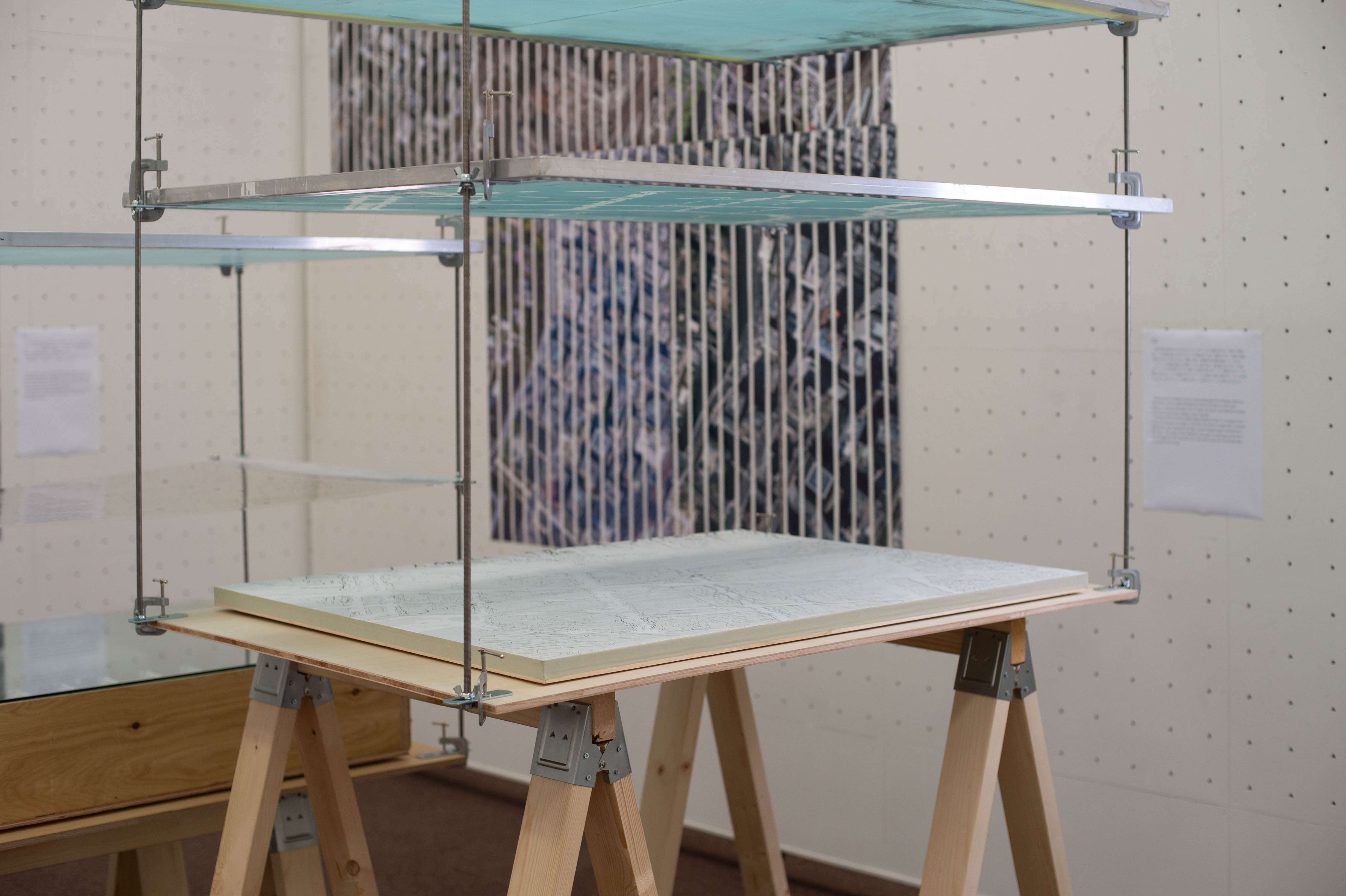
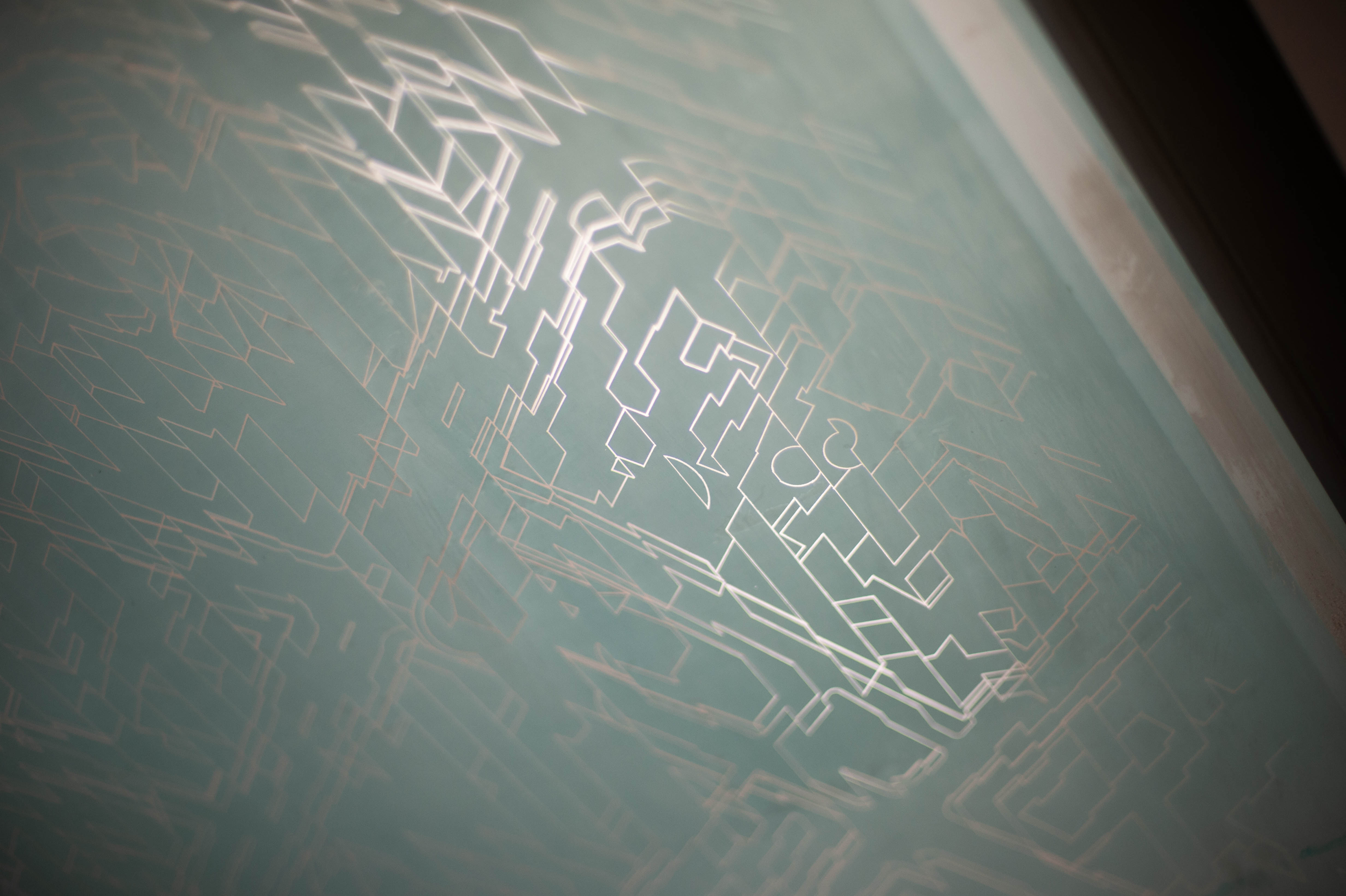
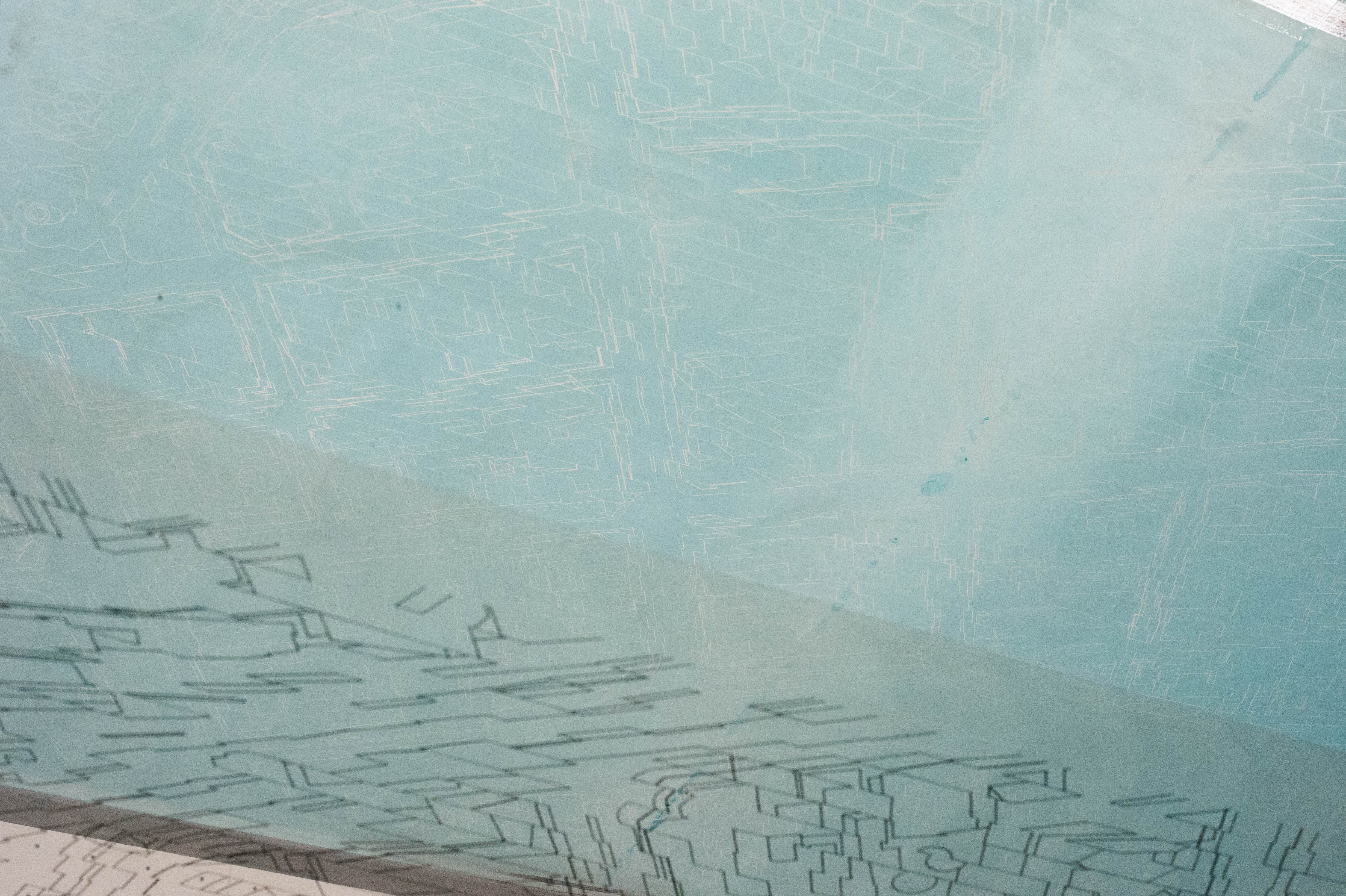
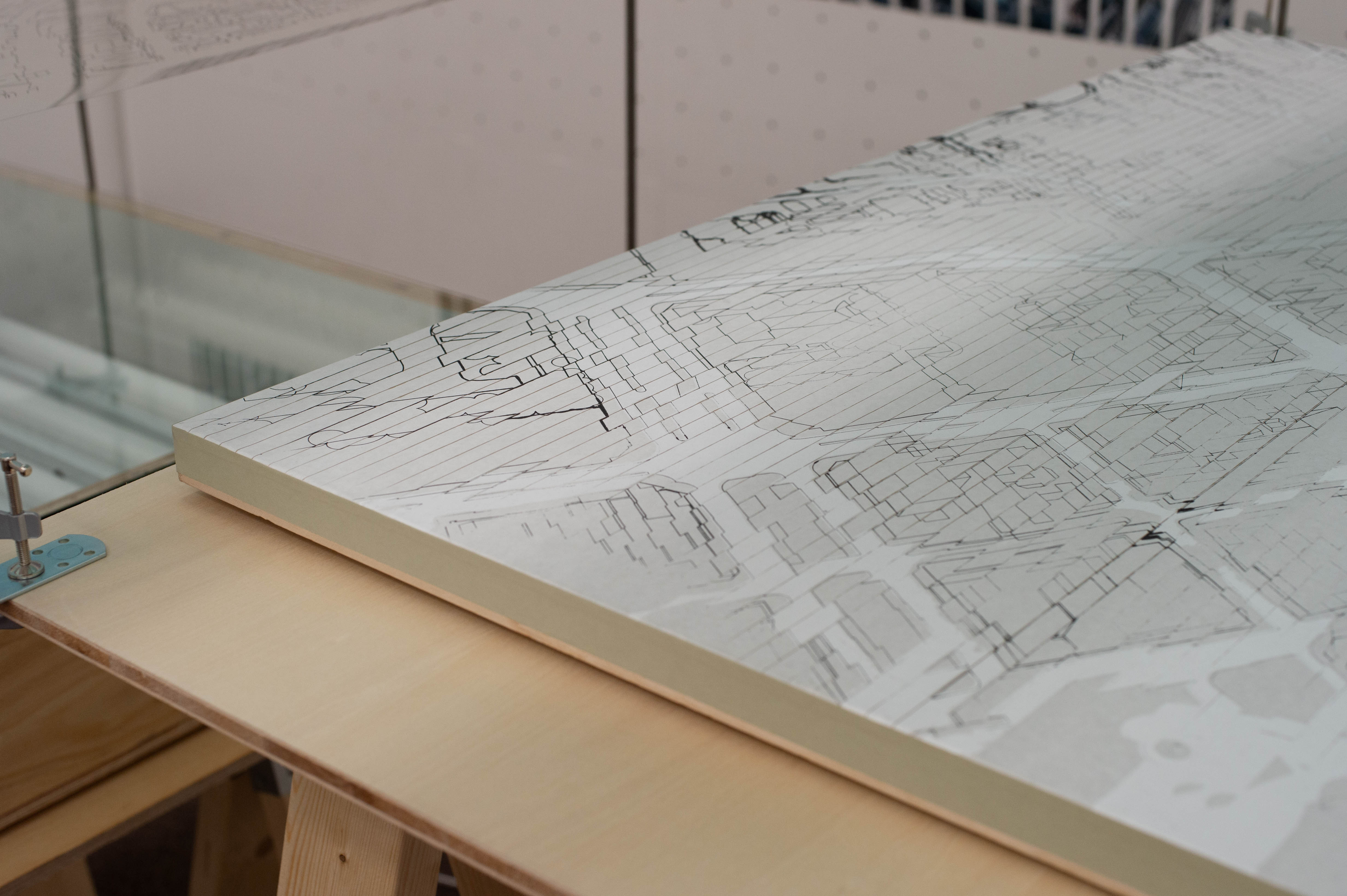
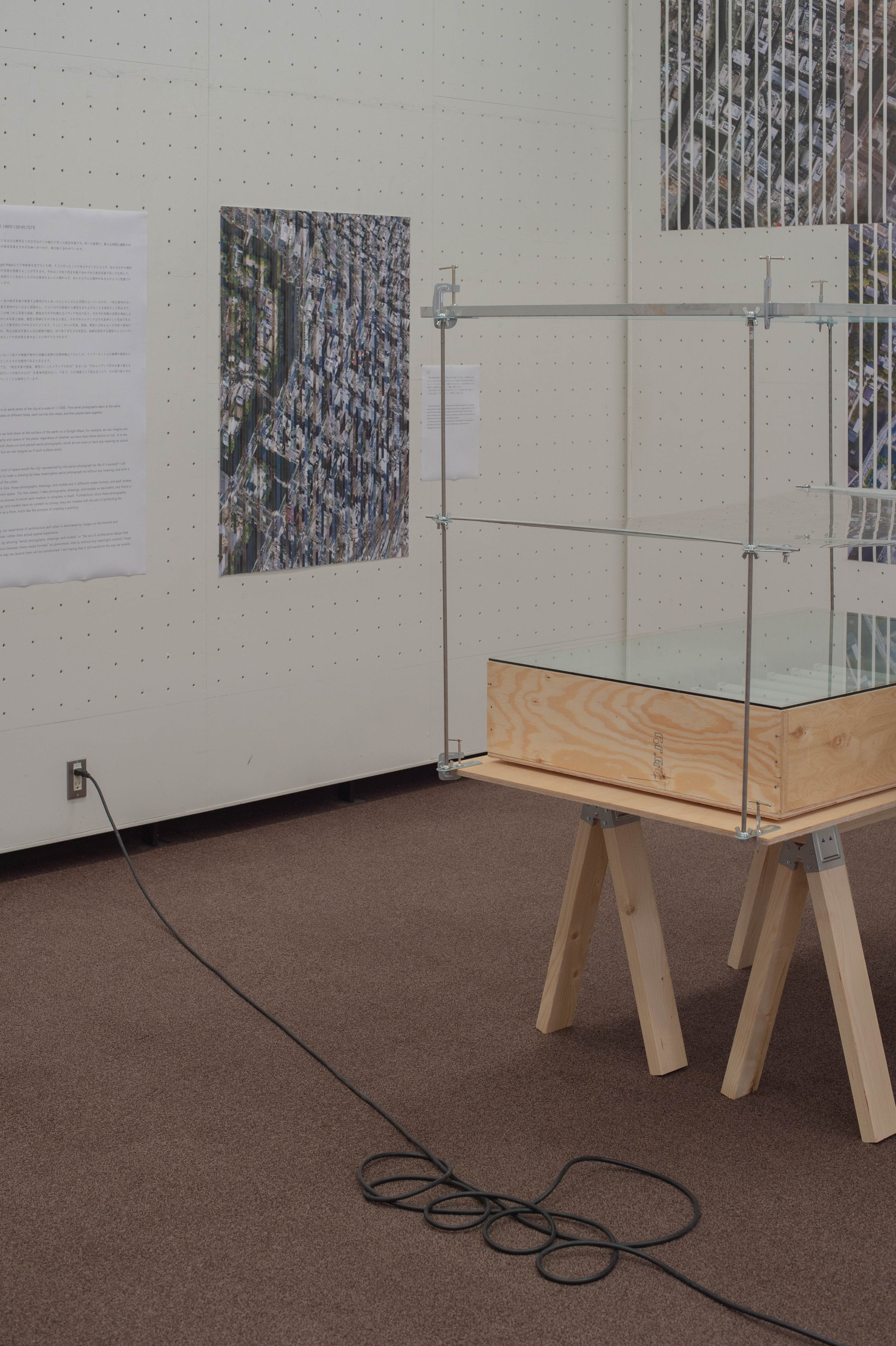
航空写真を図面化するためにトレーシングペーパーを重ね合わせ、手書きで図面化し、その原画を基にシルクスクリーン印刷を行います。図面化では、一般的な地図を制作するときと同じように、道路、街区、建造物の外形線を描画していきます。
スクリーンに原画を転写した透明フィルムを貼り付け、紫外線を当てます。この時、スクリーンには紫外線が当たると硬化する薬剤が塗られていて、原画がスクリーンに転写されます。こうして製版されたスクリーンを印刷する紙に密着させ、インクを押し当てることでスクリーンの薬剤が抜けている部分からインクが押し出されます。
Tracing paper is overlaid to convert aerial photographs into drawings, which are hand-drawn, and the original drawings are used as the basis for silk screen printing. In drawing, the outline lines of roads, city blocks, and buildings are drawn in the same way as when creating a map in general.
A transparent film with the original image transferred onto it is attached to the screen and exposed to UV light. At this time, the screen is coated with a chemical that hardens when exposed to UV light, and the original image is transferred to the screen. The screen is then adhered to the paper to be printed, and by ink is pressed against it, the ink pushed out of the areas where the chemical has been removed from the screen.
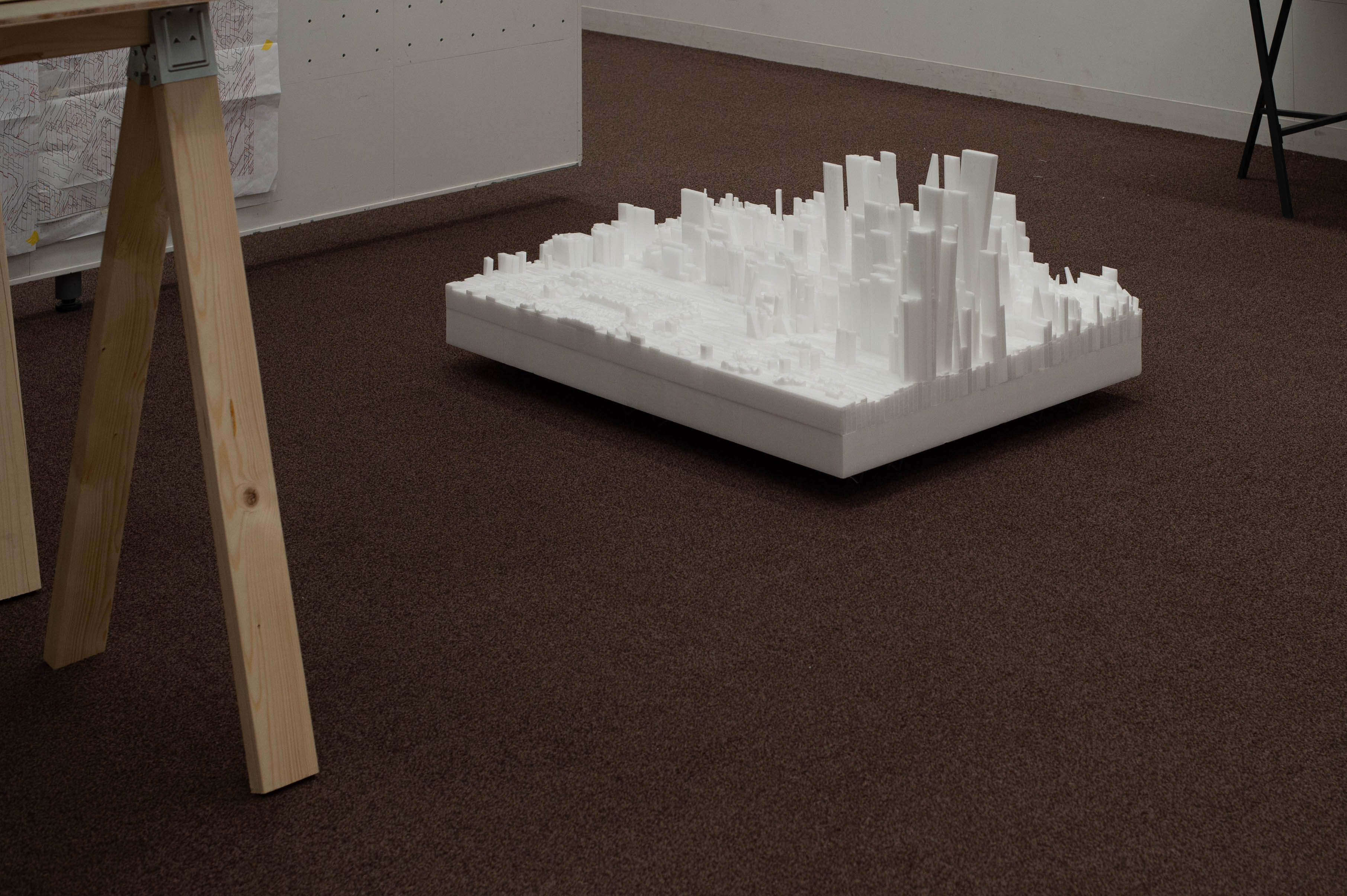
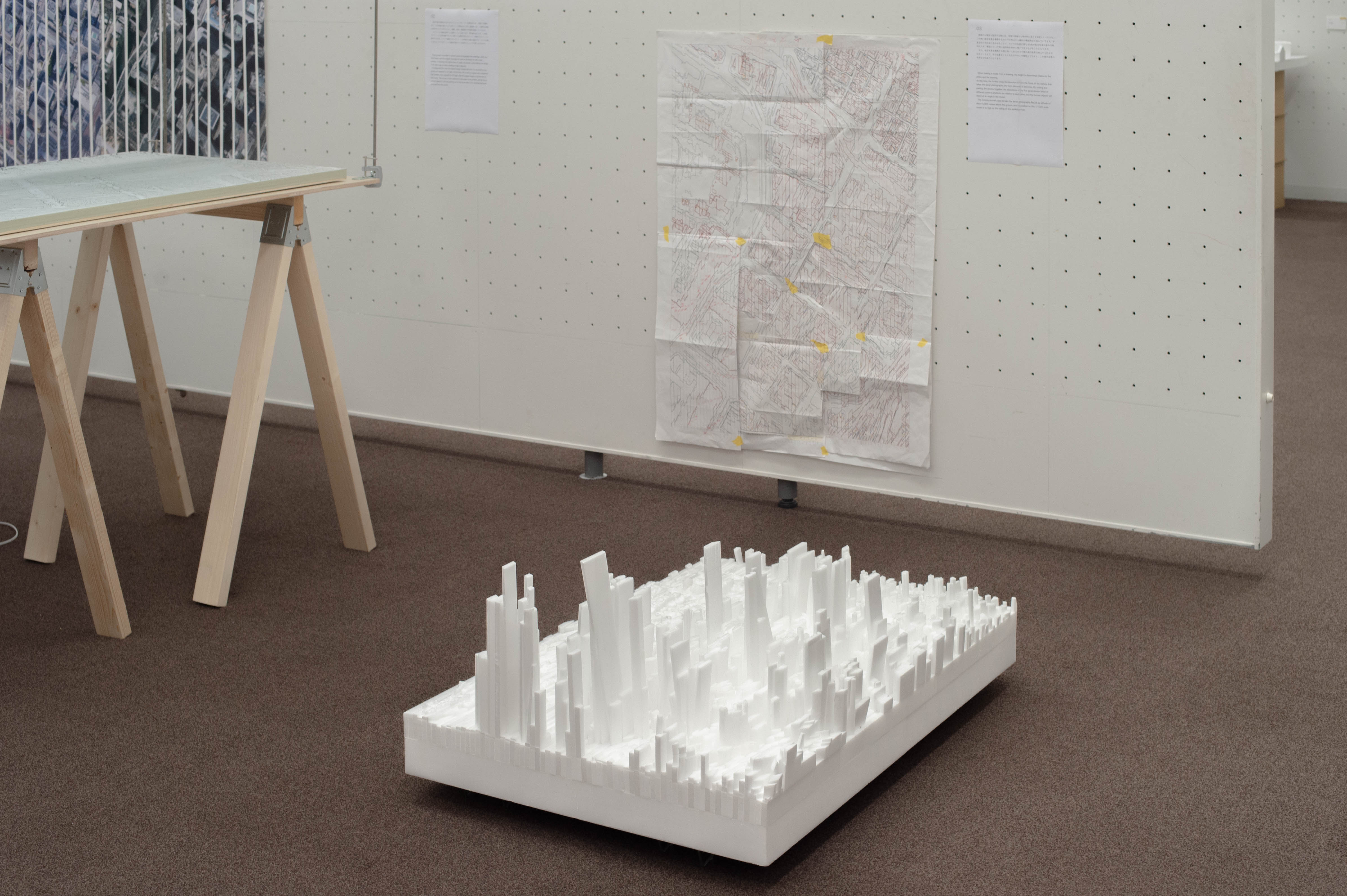
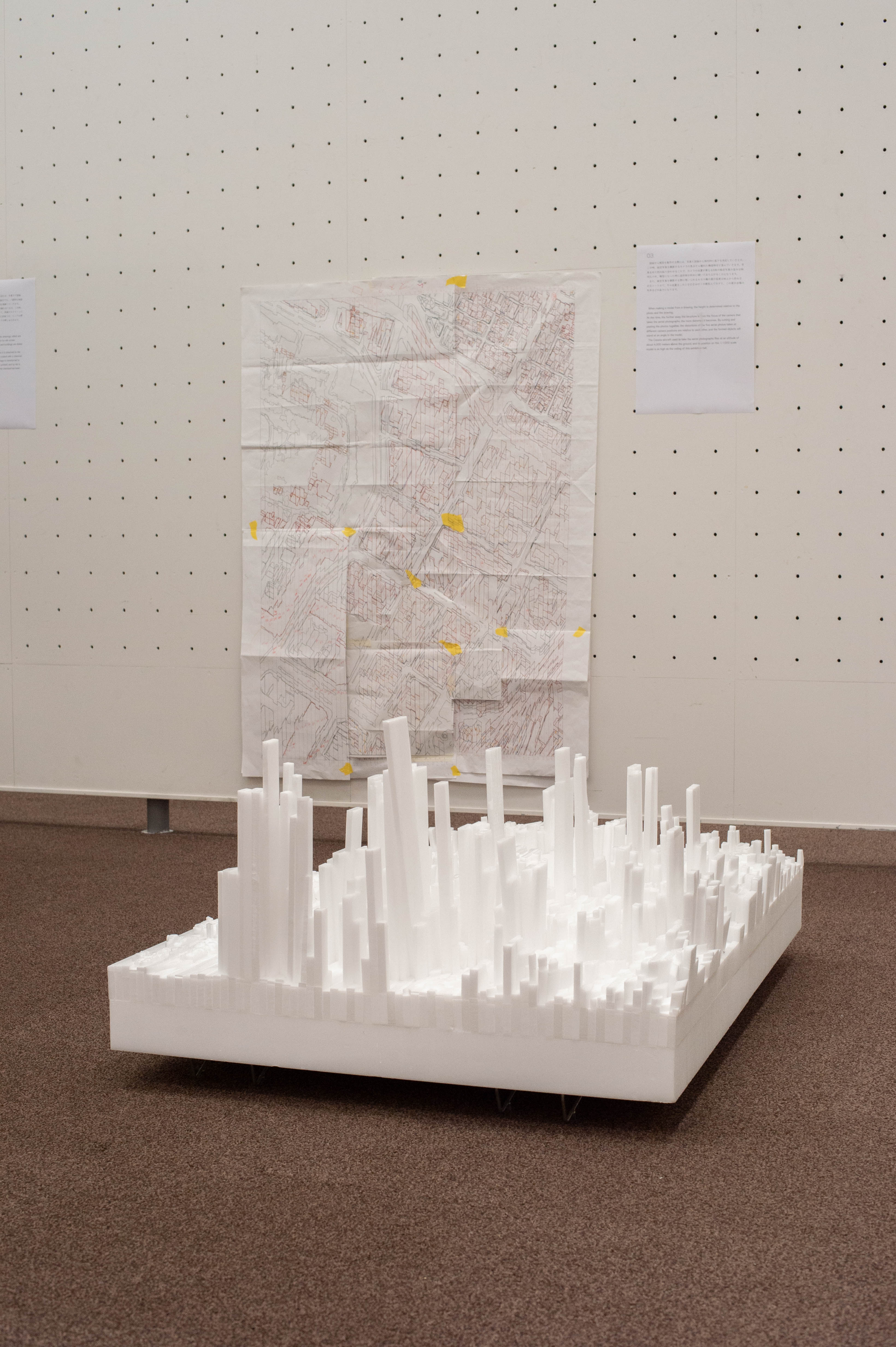
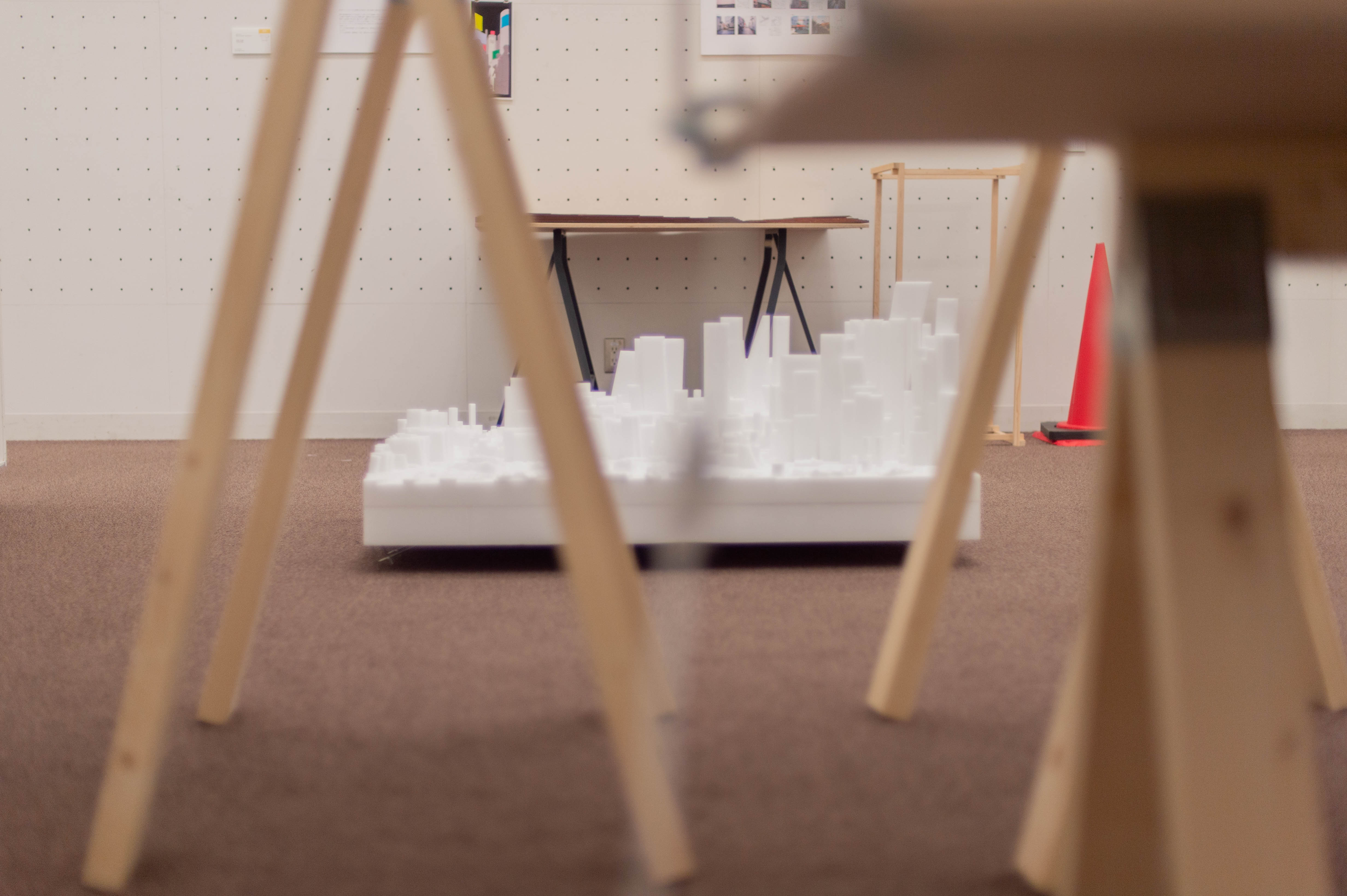
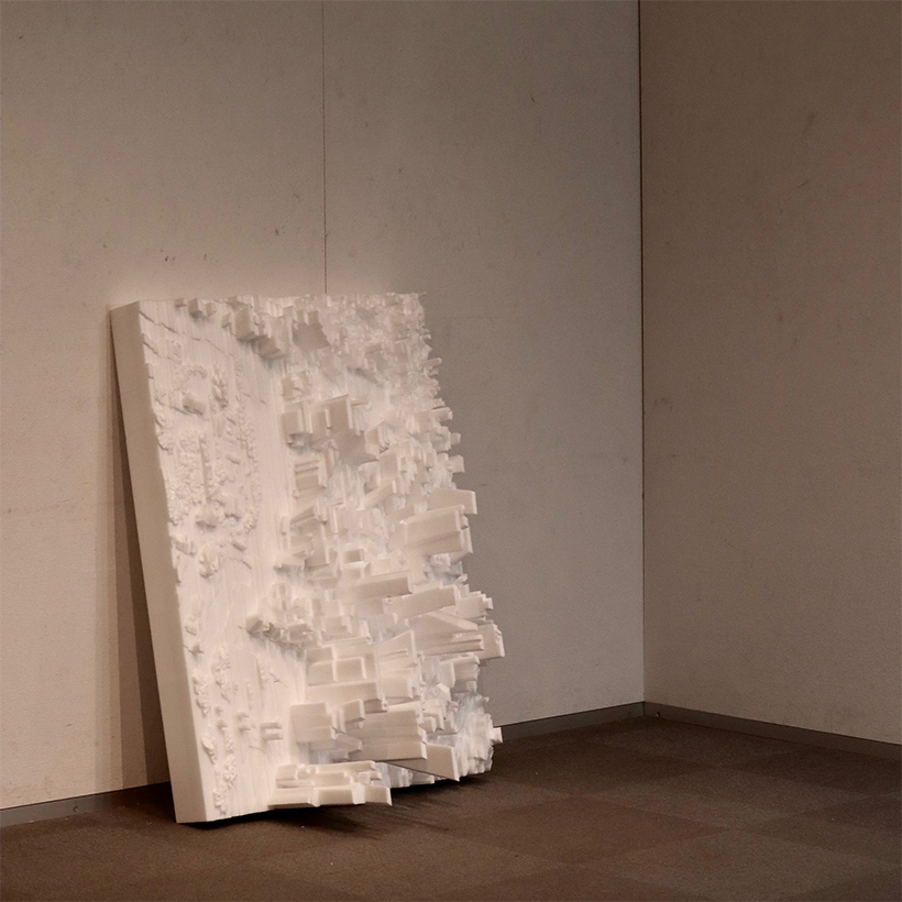
図面から模型を製作する際には、写真と図面から相対的に高さを決定していきます。この時、航空写真を撮影するカメラの焦点から離れた構造物ほど歪んでいきます。写真を切り刻み貼り合わせることで、カメラの位置が異なる5枚の航空写真の歪みは相対化され、模型になった時に造形物が斜めに傾いて立ち上がることになります。
また、航空写真を撮影する際に用いられるセスナ機の飛行高度は地上から約4000メートルで、その位置をこの1000分の1の模型上で示すと、4メートルの高さになります。
When making a model from a drawing, the height is determined relative to the photo and the drawing.
At this time, the further away the structure is from the focus of the camera that takes the aerial photographs, the more distorted it becomes. By cutting and pasting the photos together, the distortions of the five aerial photos taken at different camera positions are relative to each other, and the formed objects will stand at an angle in the model.
The Cessna aircraft used to take the aerial photographs flies at an altitude of about 4,000 meters above the ground, and its position on this 1/1000 scale model is 4 meters high.